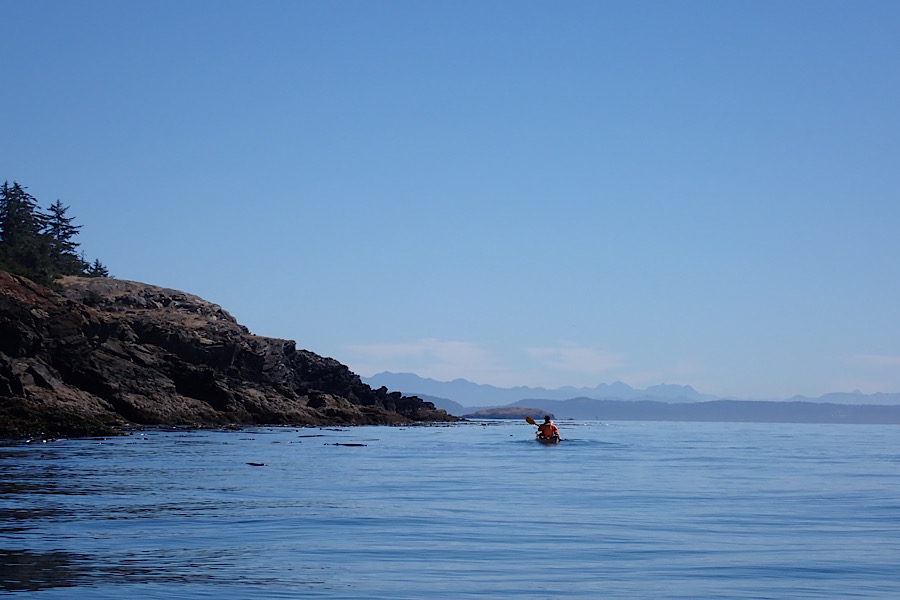
Leaving our large, noisy, pinniped friends behind we continued south past Long Island, which really isn’t that long (I’m not even going to bother checking with Edmond S. Meany on this one), and then as the current subsided, we cut east towards Charles Island and the entrance of Mackaye Harbor. I don’t know what I expected for this stretch of coastline, but it was surprisingly pastoral, with cows wandering around behind the rocky shoreline. Begging to be explored, Mackaye Harbor stretched deep into the island and we had the urge to paddle its perimeter, but our route was long enough as planned and we had to stick with the schedule dictated by currents. So we saved that stretch of coastline for another day and headed south towards Iceberg Point.
I had heard of Iceberg Point for years and that it was one of the most stunning bits of land in the Lower 48, but I had never been there myself. Friends talked about the miles of trails along rugged bluffs and through grassy meadows perched above a rocky shoreline pounded by waves with views across the Strait of Juan DeFuca to the Olympic Mountains in the distance. Iceberg Point is officially property of the Bureau of Land Management (BLM), and therefore is public property, open to all U.S. citizens. Accessing Iceberg Point requires crossing private land, however, and local landowners have grown leery of the hoards of hikers who visit the point every summer. Consequently, Iceberg Point is only open for day-use and camping is prohibited. What a shame. I couldn’t imagine a more spectacular campsite with water all around and mountains to keep you company for both sunrise and sunset.
I have always wondered how Iceberg Point got its name, and this time, Mr. Meany does prove useful. Early European settlers found “deep and smooth marks of glacial action”, and not knowing the whole area had once been under four thousand feet of ice, figured these marks were created by passing icebergs, a reasonable assumption for anyone who’s been to Newfoundland or Labrador. Now of course, we know that the whole area was covered by a massive ice sheet, but that wasn’t accepted as fact until the mid 1960s when local researchers deduced that the Cordilleran Ice Sheet had a lobe that extended all the way down to the bottom of Puget Sound. I guess there are still some folks who don’t accept that we had an ice age that ended roughly 15,000 years ago, but that’s a separate issue.
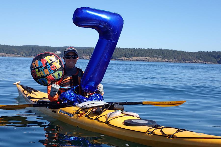
As we paddled towards Iceberg Point, Giovannina and I saw this odd-shaped structure bobbing in the water. It was dark, almost black, moving rapidly back and forth, and even a mile off appeared shiny, the sun reflecting off it as it moved. It’s hard to gauge size and distance on the water but we thought it was a couple feet long and maybe six inches wide or so. At first I thought it was an open water swimmer in a wetsuit, swimming between the islands, but the motion wasn’t regular enough. Then we thought it was a gull, maybe with a broken wing flapping in the air, but it continued to move and move and wounded animals tend to be very still. We thought maybe it was log with a branch that was twisting this way and that as it bobbed at the surface, but as we got closer, we could see it was too shiny to be a made of wood. We weren’t able to fully identify it until we were less than ten yards away. It was a cluster of mylar balloons, one shaped like the number “7”, attached with plastic ribbon to another one that read “HAPPY BIRTHDAY DAD” in large multi-colored, bubble letters. Garbage. It was garbage. Worse, it was plastic garbage. Even in such a remote spot as this, we encountered trash.
Volumes have been written about marine plastic pollution, so I won’t delve too deeply into a problem that kills thousands of marine birds and mammals every year, and will be with us for centuries to come, but I will say that this is what happens when people let their helium balloons fly off. The Law of Conservation of Matter says that everything has to go somewhere, and this patch of ocean is where these balloons ended up. Some well-intentioned son or daughter probably bought these balloons for their dad’s birthday party; maybe it was a surprise party for his seventieth birthday. Everyone had a great time, ate too much, drank too much and someone let the balloons go by accident. One of the grandkids watched it sail off into the distance and cried, “Grandpa lost his balloons!” At which point, a surly teenager said, “Great, now a sea turtle will probably eat it and die.” The adults scorned the offending adolescent and then returned to their beer or wine or whatever inebriant they were using to dull the anxieties of another family gathering. And now here they were on the deck of Giovannina’s kayak. Thankfully, they appeared not to have killed any turtles yet, but we didn’t want to take any chances and so we popped them, wrapped them up and stowed them with the rest of our garbage to be pitched at the next available trash can.
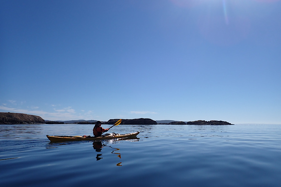
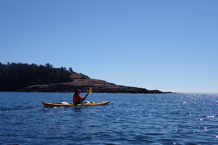
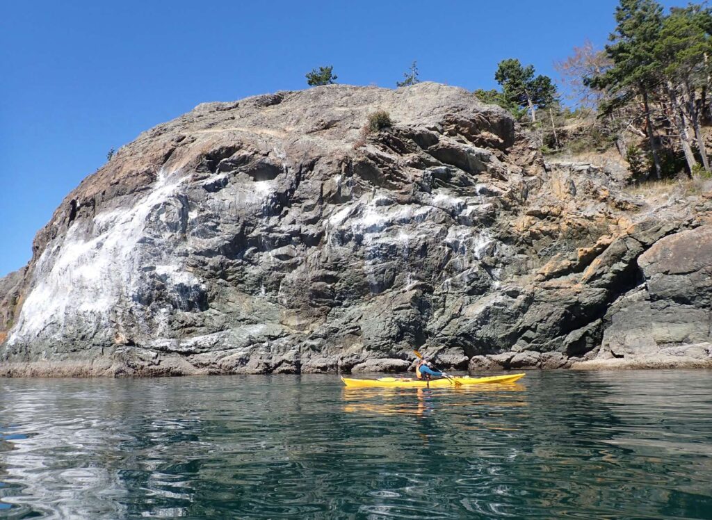
We continued our paddle eastward around Iceberg Point and were now fully in the Strait of Juan De Fuca. On a stormy day, this spot would be brutal, but today, without a hint of wind, it was heaven. The water’s surface greeted each paddle stroke with placid indifference as our kayaks glided across the halcyon sea. Occasionally, we’d spot gulls circling overhead and there were the ever-present pigeon guillemots, the little “footballs with wings”, paddling those bright red feet at the surface before lifting wings to plunge headlong to forage for fish in the icy depths below. We had heard that puffins nested along this stretch of coastline and were on the lookout for the telltale white guano on the sea cliffs that would mark their hangout site.
We hugged the shoreline, wanting to take in as much of it as possible, and saw more of those same pastoral farms with cows, sheep and goats fenced in large pastures. But we also saw large, hangar-like buildings with “living roofs” full of grasses and wildflowers. We later discovered that some very wealthy people – which for the San Juans is saying something – own property along this stretch of coastline, and we were probably looking at someone’s secret get away. I don’t know, but if they ever ask me to join them for a sleep over, I’m grabbing my teddy bear and pillow and hopping on the first ferry to Lopez.
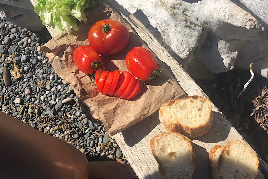
We stopped for a quick lunch break of fresh mozzarella with lettuce and tomatoes (lunches after resupplying are always the best) at a cove just outside of Aleck Bay. This lunch was particularly special as both the lettuce and tomatoes were grown in our garden back in Seattle and brought to us with loving care by Giovannina’s parents. Piling the ingredients on top of slices of French bread from the bakery in Friday Harbor, we drizzled balsamic and olive oil over the top of each one making for a gourmet seaside meal worthy of the Italian Riviera.
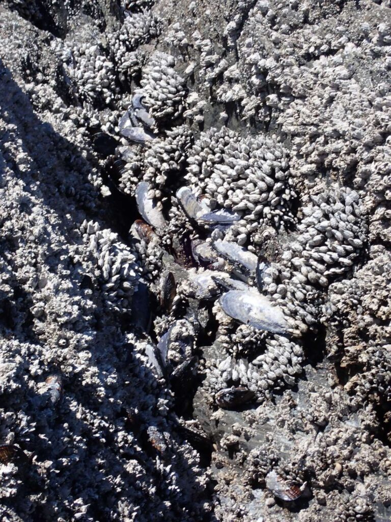
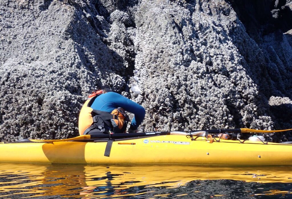
After our quick stop we explored the rocks outside of the bay and and found, growing just above the waterline, huge California mussels, some measuring eight inches long. Unlike the smaller blue mussels, these guys are only found in exposed, surf-pounded spots, another indicator that this area gets plenty of wave action. But with the seas so calm we decided to see if we could harvest a few of them for dinner. Giovannina paddled close to the rocks and leaned over while I held her kayak’s gunwale to keep her from flipping. She grabbed a big, juicy one and pulled and pulled, but the mussel wouldn’t budge. She tried using the knife from her PFD to pry it off, but it still didn’t move, so we switched places and I have it a shot. I grabbed the mussel and began to twist, trying to snap the byssal threads that attached it to the rock. I twisted and twisted. Slowly the threads yielded, and after about fifteen minutes and a few bloody knuckles, we were able to collect four mussels – not much reward for a lot of work.
The reason for our difficulty in harvesting these bivalves has to do with the remarkable strength of byssal threads. No matter how often I encounter them, I am always amazed at their immense holding power. Each mussel secretes between twenty and one hundred of these little threads and creates the equivalent of Spiderman’s web of fibers that attach it to the rock. The crazy thing is that each thread is stretchy but also super strong – an individual thread can hold up to ten pounds. So with a hundred threads, one mussel can withstand a thousand pounds of force before it’s dislodged from a rock, an important adaptation when you’re living in a wave pounded shoreline with large pieces of drift wood smashing into you. In addition to being so strong, these threads don’t degrade in seawater, which is almost unheard of for an adhesive. Not surprisingly, researchers have been studying how to synthesize similar materials that could be used in marine engineering or even the biomedical field.
While you might be surprised to hear that mussels are being studied for this miracle material they produce, humans have actually been working with byssal threads for thousands of years. Since the time of the Egyptian Pharaohs, people have been using these fibers to make a wonderful fabric known as sea silk, or byssus. Fabricated from the woven byssal threads of the Mediterranean fan mussel (Pinna nobilis), sea silk was renowned for being extremely light while also having great strength and warmth. It was said that one pair of ladies gloves could fit in half of a walnut shell. Unfortunately, the process of making sea silk required a lot of fan mussels – one hat alone used eighty mussels – and with the advent of synthetic fabrics, there is no longer the same demand for such a sturdy, lightweight fabric. Consequently, there are only a few people left who know the art of making sea silk. A small group of women on the island of Sardinia keep the tradition alive, but only for cultural, not commercial purposes. Only sixty known items made of sea silk are in existence today and the last public sale may date as far back as 1767.
I placed our few mussels in a mesh collecting bag, closed the mouth and dangled it over the side to keep the mussels in the water as I paddled. I kept this bag behind my seat in the event I actually caught a fish while kayaking. I brought my fishing pole on this trip in the hopes of catching salmon, but it looks like I’d be settling for mussels today.
We continued east past Hughes Bay and on the promontory just before McArdle Bay we saw a tall rocky cliff stained with the familiar white marks of guano, aka bird poop. Hoping to spot the elusive tufted puffins we’d heard could be found along this stretch of coastline, we paddled closer, binoculars at the ready to watch these adorable little birds. We searched and searched, but never saw one, and sadly none were spotted during the rest of the trip either. Tufted puffins, with their wild bills painted yellow and orange and lavish plumes of feathers over their eyes, look like they would be more at home on a Mardi Gras float or as David Bowie impersonators than hunting fish in the Salish Sea. More common on the outer coast around places like Destruction Island (awesome name for an island), they are not frequently found around the San Juans, though they used to be more common. The ones that are found are probably breeding on Smith Island, one of only two breeding colonies left in the Salish Sea. Unlike other seabirds, such as murres, that nest on the bare rock of ocean cliffs, tufted puffins require thick glacial deposits three to six feet deep in which to dig their burrows, which makes them vulnerable to predation by introduced species like fox and rats.
Historically, tufted puffins maintained adequate breeding sites throughout much of the San Juan archipelago, including on Colville Island right around the corner from where we were paddling, but in the last fifty years, their numbers have dwindled and there are currently no nesting colonies left in the islands. Why have their numbers declined so much? It hasn’t just been here in the islands; up and down the West Coast, tufted puffins are disappearing from their former range. According to the U.S. Fish and Wildlife Service, since the mid-1990s, tufted puffin populations in Oregon and Washington have plummeted more than ninety five percent. Gill netting has been a one major culprit. One study by the U.S. Fish and Wildlife Service estimated that as much as twenty five percent of the North Pacific tufted puffin population was killed by gill nets each year. Combine that with deterioration of the ecosystem from overfishing, climate change and ocean acidification, and it’s no surprise these little guys are struggling. Oh, and don’t forget the ingestion of plastic pollution. Given all of these factors working against them, it’s no surprise we didn’t see any puffins while we were paddling the shore of Lopez. I’m surprised all of the tufted puffins in the Pacific Northwest haven’t just packed their bags and headed north to hang with their brethren in Alaska, where the population seems to be much healthier.
We had some time to kill before the currents shifted and so leisurely made our way towards Watmough Bay. Colville Island, just offshore rose like a fortress out of the ocean. The air was completely still and the only sounds we heard were the lapping of tiny waves across the rocks and the infrequent wine of a boat motor off in the distance. The water here was surprisingly shallow and we could easily see the algae and kelp that lined the rocks just a few feet below the surface. Twenty feet or so from the shoreline, thick beds of bull kelp provided habitat for fish and whole array of other marine life. The kelp blades bobbed along the surface, twisting in the current. The long stipes (the trunk, if you will) of several kelp had woven together into braids like the hair of an underwater goddess.
We were soon joined by several harbor seals, bobbing their heads up to the surface, watching us cautiously. We’d learned that if we could watch them without moving or paddling, they would spend quite a while at the surface staring back at us with those infinitely deep liquid black eyes of theirs. We saw a small one, a pup barely weened from its mother, sliding along the surface a dozen yards or so away from us. Around the San Juan Islands, most pups are born between June and August and nurse for about a month before heading out on their own. By the time they start hunting for themselves, most pups weigh about sixty pounds, which for a human would be an absolutely enormous one-month-old child, but for marine mammals, it’s actually quite small. Unlike their much larger pinniped cousins, harbor seals are some of the smallest seals, growing at most to about six feet long and weighing about one hundred sixty pounds, which is absolutely Lilliputian compared to a twelve foot long, eight thousand pound elephant seal.
This little pup was most likely still learning when and when not to be skittish and so was taking a bit of risk watching us as we cruised through his neighborhood. About one fifth of harbor seal pups don’t survive their first year, though a study of harbor seal mortality in the Salish Sea found that in 2005, forty percent of new born pups died. The cause of death that year, as it is most years, was disease. Number two was malnutrition. While an average annual mortality rate of twenty percent may seem high for a cute mammal like a harbor seal, it’s actually quite typical for most wild animals, and overall the Salish Sea harbor seal population is in good shape. After the passage of the Marine Mammal Protection act in 1970, the Salish Sea harbor seal population grew exponentially at a rate of about six percent per year. It’s estimated the population has reached a stable carrying capacity of around forty thousand individuals, or about three per square mile. This would make the Salish Sea possibly the most densely populated region for harbor seals in the world. No wonder we saw so many on our trip.
By now the currents had shifted north and so we continued our way around Colville Point and Watmough Head. As we passed Colville Point, we could see folks walking on trails atop the bluffs that lined the shore. It looked like there was a sort of park up there. This section of the San Juans was totally new to me, and I always pictured this area as being wild and untouchable, so it was a bit odd to see day hikers with small children and canned beverages wandering the landscape. When I posted on Facebook that Giovannina and I were doing this kayak a trip, a friend reply, simply “WATMOUGH!” I had no idea what she was referring to. I found Watmough on our chart and asked some other friends in Seattle about it, and they just shrugged. When we got to the San Juan Islands I asked just about every kayaker I met about Watmough, and got the same response. “Wat…what?” It wasn’t until I mentioned it to Amy’s husband, Kees who grew up in the Islands, that I learned something about it.
“Watmough…yeah.” he said (pronouncing it “waught-mow”.) “That’s my favorite spot in the islands. Gorgeous. Deep protected harbor. Thousand foot cliffs. You gotta go there. I went to a music festival there one time. So much fun. So many people. Mostly really high. But still really cool.”
And so imagining scenes of cliff-diving, drug-addled teenagers frolicking across the landscape, we rounded the corner of Watmough Head and made our way into Watmough Bay.
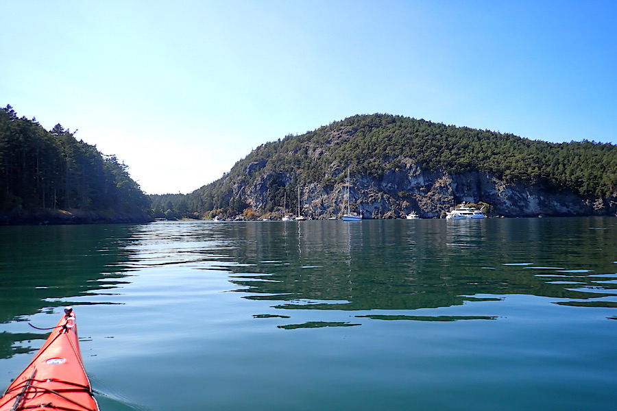
Watmough Bay (and Watmough Head) are named for John Goddard Watmough, a U.S. Army Lieutenant wounded at Fort Erie in the battle of Niagara in 1814. As far as I can tell, John Watmough never saw the place named after him. But his sons were in the Navy, and ostensibly knew someone in the Wilkes Expedition, which named this place in his honor, a magnanimous gesture to be sure. The bay itself is deep enough to moor a dozen or so boats, and being one of the only protected anchorage on the west side of Roasaria Strait it’s very popular amongst sailers, which explains why the kayakers I met didn’t know bout it – it’s a sailing destination more than a kayaking destination. The land around Watmough Bay is cooperatively managed between the San Juan County Land Bank and San Juan Preservation Trust, and they do a great job taking care of the place. There’s a nice outhouse up the trail from the gravely beach and all of the trails were well marked. They even had a docent, a kind older woman, who wandered around wearing a reflective vest (ala crossing guard), reminding people that they couldn’t camp on the beach and asking how many boats were moored in the bay. It seems as though she was tasked with conducting a survey of the boats in the harbor, but had left her glasses at home. I was tempted to mention the pirate ship moored next to the Catalina 42, but thought better of it.
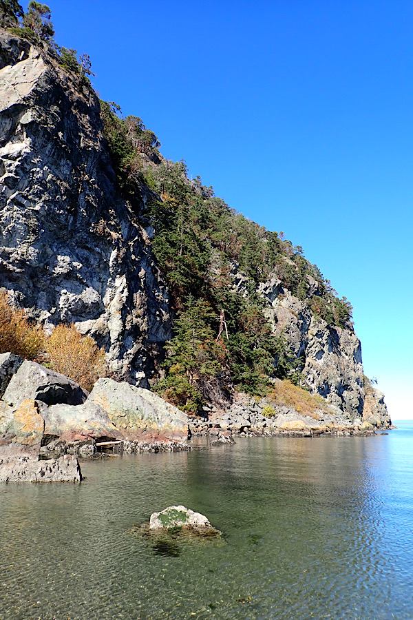
The bay itself is absolutely stunning. It reminded Giovannina and I of something from the Italian Riviera, though a lot colder. The water was clear and shallow, and as we paddled to the beach we could see the cobbles and seaweed lining the bottom. The eastern shore is a rugged cliff extending almost five hundred feet vertically from the waters edge. Madrone and Douglas fir cling to small outcroppings here and there and the top is dotted with grassy knobs and more madrone to add color and texture to an already picturesque view. We wanted to spend more time investigating the area, but as the nice lady reminded us, there was no camping and we still had several miles of paddling to get to our campsite on James Island. We would be spending Labor Day Weekend on James with our friends Laurel and Omar, and figured we could return return with them in a couple days to do some more thorough exploration.
After a quick pee break and leg stretch, we got back in the boats and paddled north to James Island. Our arms were tired from a long day on the water, but we were energized from all that we’d seen. We felt like we could paddle for another week without a break, but we were also looking forward to seeing our friends and being able to share such a beautiful place with people we loved. By now, the current had shifted northward and the flood was flowing up Rosaria Strait. We opted to stay well offshore avoiding the back eddies and rode the tide rips and whirlpools all the way to James Island.
At James, we found a nice campground in the protected bay on the island’s southwest corner and landed the boats next to a public dock where a sailboat and motorboat were tied up. There was a Marine Trail site on the cove’s eastern shore, but we opted for a south facing campsite with fewer trees and more sunlight. We unloaded the boats, set up camp and enjoyed a lovely dinner overlooking the water. As the sun set, we reminisced about the day’s exploits and marveled at the long journey we’d taken to get to James Island. For most kayakers, James Island is a quick weekend paddle from Anacortes. But we took a much longer route to get there – Blake Island, Langley, Camano Island, Deception Pass, Cypress, Sucia, Stuart, Cattle Pass, and many more stops in between. We had now seen everything in the San Juans we had set out to see and now the trip was entering its final phase. We were excited for what lay ahead, but also a bit nostalgic for what was behind us. Thankfully, whatever was to happen, we’d be sharing it with friends and loved ones, and we knew we’d have stories for the rest of our lifetime.