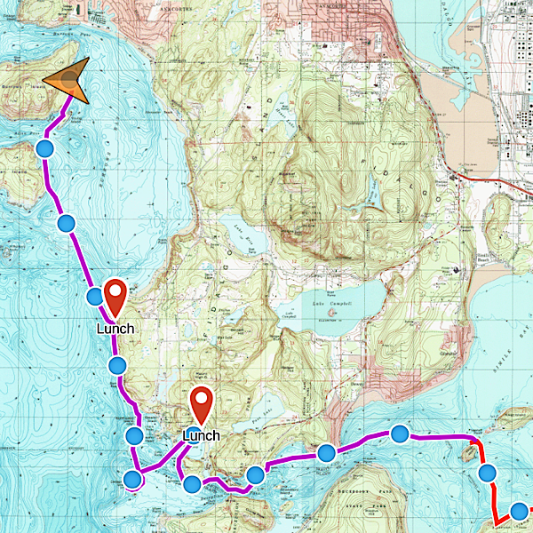
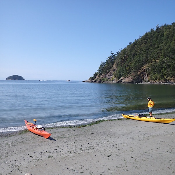
I knew that paddling through Deception Pass was going to be a seminal moment during this trip. Deception Pass is where we would leave the mostly calm and protected waters, sheltered by Whidbey Island, and make our way into the sea. The western end of the pass faces directly into the Straight of Juan de Fuca and gets the full brunt of the North Pacific swell. In addition, the currents through the pass can exceed eight knots, more than strong enough to flip a kayak. So we spent a day scoping out our route through the pass and timed it so that we would cross during a slack before ebb, this way if we were late, wed still get pushed through, hopefully without too much force.
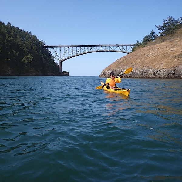
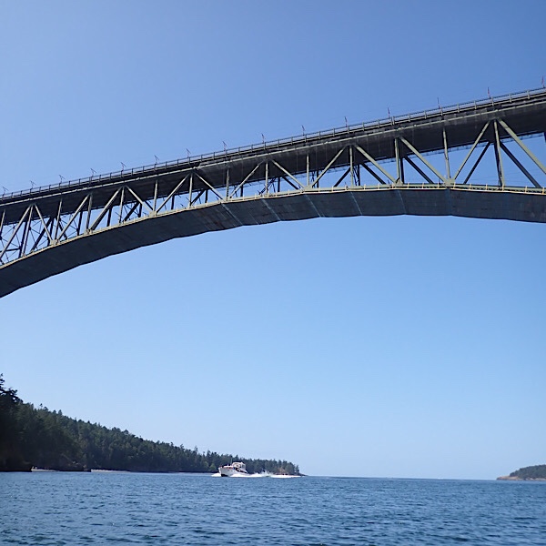
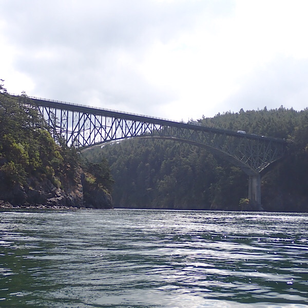
I’d like to say that running the pass was a huge adventure, but actually it was pretty chill. We timed the slack really well and got there when it was about as still as a lake. We checked out Canoe Pass, the smaller pass to the north of Canoe Island, whose steep walls and narrrow channel are quite picturesque, but they were sandblasting the bridge, so we opted for the main channel and it was totally chill. Still quite beautiful, however.
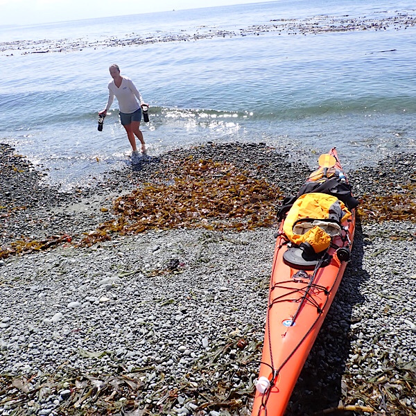
After the pass, we headed to Bowman Bay to fill our water and then went to explore Deception Island. Our friends Laurel and Omar mentioned that it might be possible to camp there during the right tide. By now the currents had picked up and there was a decent swell rolling in from the straight. We fought through one tide rip to get to the island and then bobbed and weaved on the swell as we made our way around looking for a landing spot. Unfortunately, none were to be found, but the scenery was stunning. Jagged, rocky blocks thrust into the the swell with surf crashing over the submerged boulders. We made our way around the acre or so of land and then came back to that same tide rip, this time running it north towards the cliffs beyond Bowman Bay.
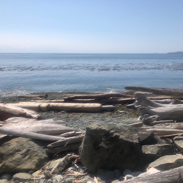
The section of coastline north of Deception Pass and south of Anacortes is like something you’d find in Alaska or the West Coast of Vancouver Island. Here the cliffs rise a hundred feet straight into the air. Sea caves dot their bottoms, and the swell makes a WHUMBBING echo as it surges inside, gets slapped against the roof and is chugged back out.
We stopped at a small beach for lunch. We saw a house far above us on the cliffs edge, but there was no way anyone was going up or down that face. With a hundred foot rock wall behind us and nothing but blue sea in front of us we ate our hummus and tortillas while sitting in the shade of a lone scraggly oak, holding desperately onto the crumbling scree of the rock that made the beach we had landed on.
That night we stayed at Burrows Island, at the CMT Site, a dark, wooded spot on the northeast corner looking directly at the rows and rows of suburban homes that make up the neighborhoods around Anacortes, our next stop. So strange to be so close to much civilization, yet feel so vulnerable to the whims of weather, ocean and tides. And with that thought in my head, I crawled into my sleeping bag, laid my head on my pillow made from my sweaty clothes wrapped in an old fleece and fell asleep dreaming of a pizza delivery to our campsite the next night.
Margy Ransford
So awesomely cool you guys! I was just thinking of you today, missing seeing you both, and then Debbie Smith posted a pic and a link today! Smooth seas to you. XO, Margy
womoses
Thanks, Margy! Sorry for the late reply. Just found this. Sorry we missed you at NAME this summer. Hopefully we’ll be seeing you next year in Victoria. Hope all is well and the smoke isn’t too bad up there. Peace.